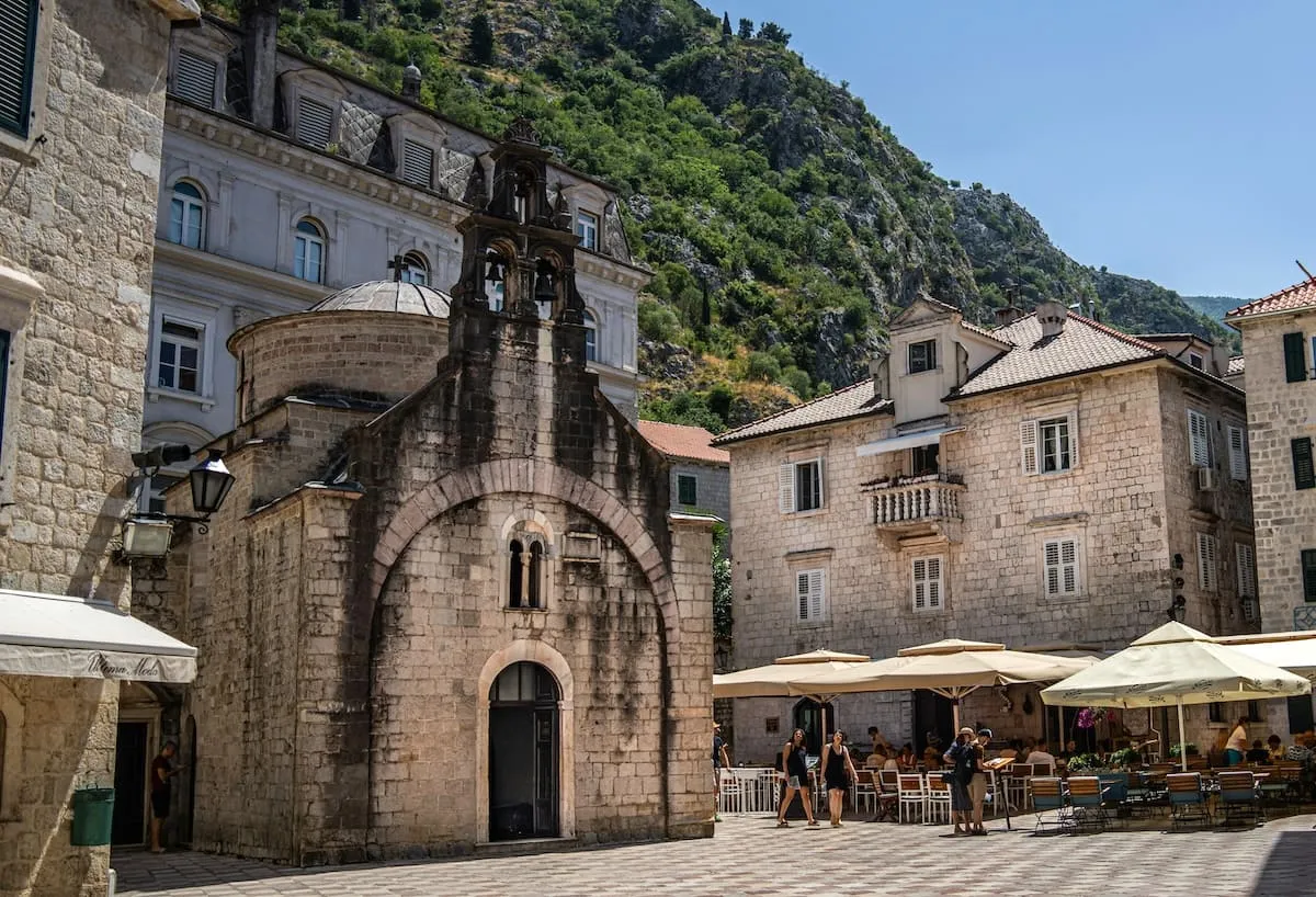
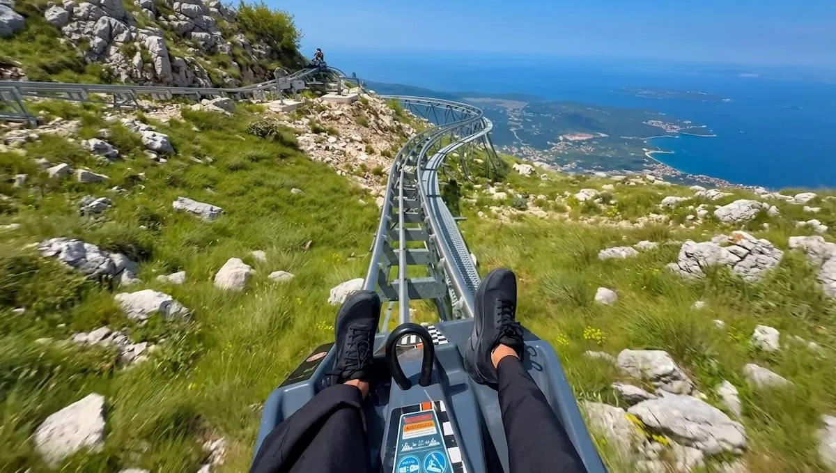
The mountains surrounding Kotor form part of the Dinarides, a limestone range that plunges straight into the Adriatic. The result: trails that climb steeply, panoramas that change with every bend, and paths laid out in the Austro-Hungarian era that have remained almost unchanged since.
Here are the hikes that are truly worth the detour, ranging from a two-hour walk to a multi-day trek.
The climb to Kotor Fortress
This is the most accessible hike, and probably the most popular. The route starts at the North Gate (River Gate) in the old town. It’s a 2.5 km round trip, with a 254-metre elevation gain, taking about 1½ hours.
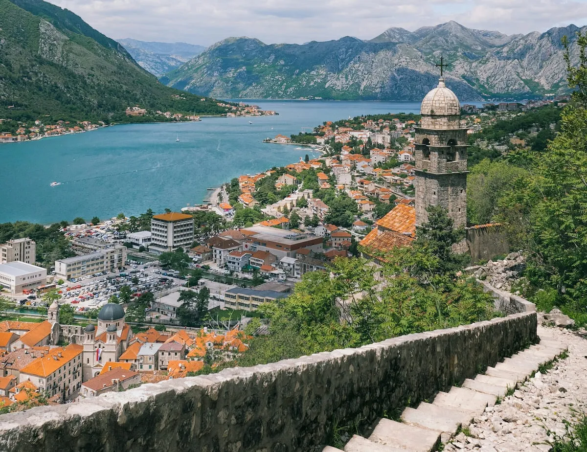
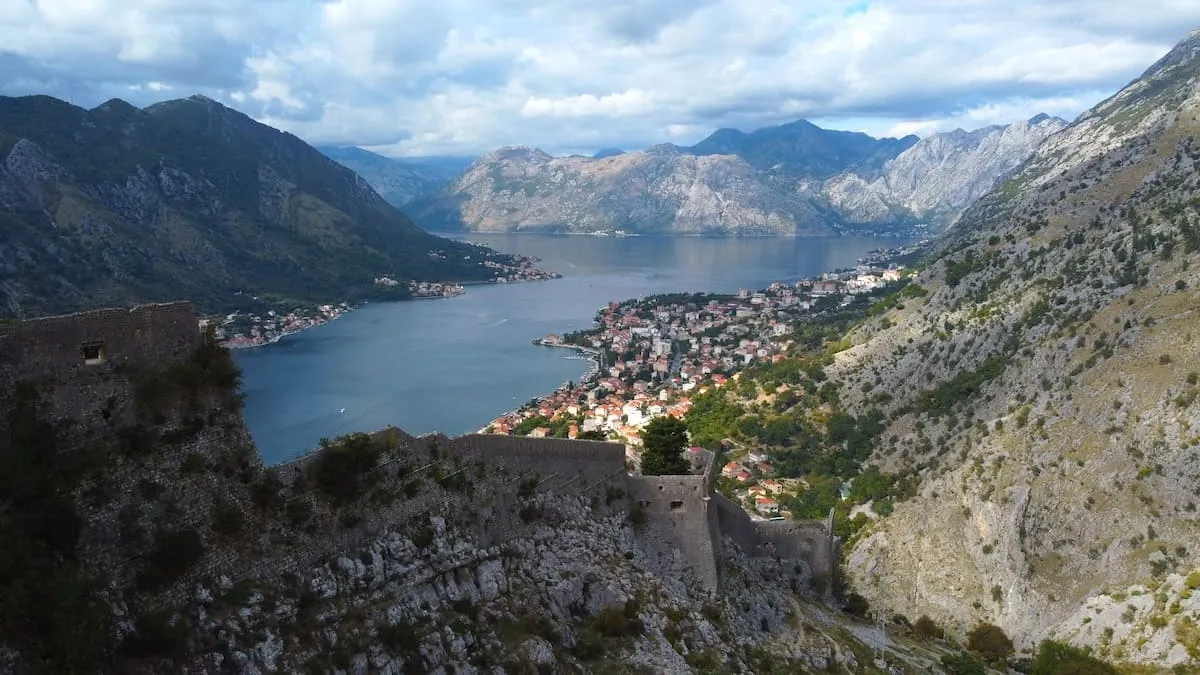
The path climbs 1,350 steps, winding its way up in a series of hairpin bends, to the fortress. It lies in ruins, but it is precisely from here that you get the best bird’s-eye view of the old town and the bay.
Entry costs €8, though there is an alternative route that allows you to avoid this charge. Set off early in the morning: the light is better and the heat hasn’t set in yet.
The Ladder of Kotor
This is a hike that is well worth setting aside a whole morning for.
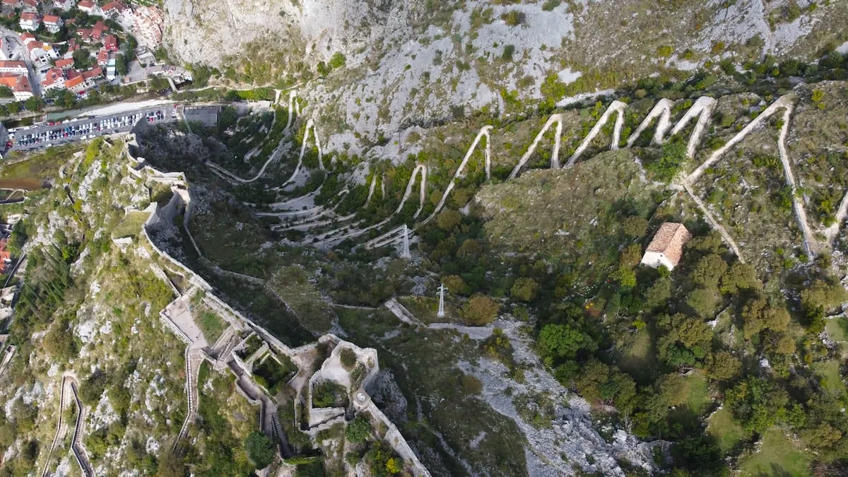
The route starts on Tabačina Road, near the River Gate. It is an old Austro-Hungarian trail dating from the 19th century, which once linked Kotor to Njeguši and then on to Cetinje. The path climbs via 70 hairpin bends, runs alongside the Skurda Canyon, passes the ramparts and the little chapel of Sveti Đorđe, before offering a view of the bay from nearly 3,000 feet up.
Two options: a 6.4 km one-way walk to the main viewpoint, or the full 14.1 km loop for the more ambitious. Allow between 3 and 6 hours depending on your choice.
Access is free, making it one of the best deals in the region. Along the way, two small shops sell refreshments, which come in handy in summer. For those wishing to extend the walk, a further 40 minutes will take you to the Krstac Pass.
The Vrmac Ridge
A 17-minute drive from Kotor, the trail starts at Fort Vrmac. For those without a car, the trail is also accessible from Muo.
One of the most popular attractions in Kotor, this is the easiest hike of the bunch: an 8.5 km round trip, with 282 metres of elevation gain, taking around 3 hours, on terrain ranging from 469 to 765 metres in altitude.
Fort Vrmac itself is an Austro-Hungarian ruin with tunnels that can be explored, provided you have a head torch. The trail then climbs up to Sveti Ilija (765 m), from where the view takes in both the inner bay of Kotor and the outer bay of Tivat, all the way to the Adriatic.
Along the way, cows, goats and pigs roam freely, unfenced, as if they were at home. The best time for this hike is at sunrise or sunset, when the low-angled light illuminates both bays at the same time.
The summit of Pestingrad
It is Kotor’s ‘local mountain’, the familiar peak that can be seen from the town without one necessarily realising that it is possible to climb it.
The route starts from Etno Selo Sveti Georgije or the Krstac Pass. From Krstac, it’s a 5.7 km round trip taking around 2½ hours. Starting directly from Kotor, the route stretches to 20 km and takes 7 to 8 hours.
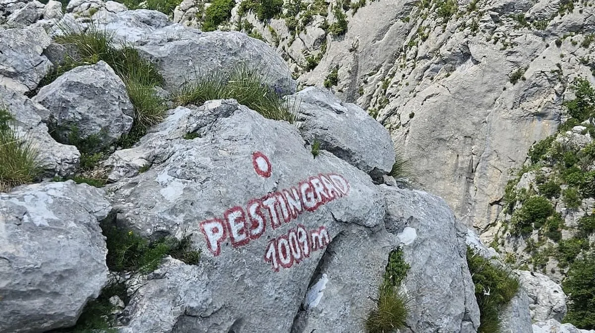
The terrain is karstic, wild and still relatively uncrowded. One exposed section requires a fixed rope and some easy climbing. At the summit (1,009 m), the 360° view takes in the Bay of Kotor, the Adriatic and the peaks of Lovćen, with the red and gold Montenegrin flag flying at the top.
It is much quieter than the paths around the Lovćen mausoleum. Bring an extra layer: the summit is windy, even in the height of summer.
Here is a summary of the peaks mentioned and their altitudes:
| Peak / high point | Altitude |
|---|---|
| Kotor Fortress | 260 m |
| Ladder of Kotor (main viewpoint) | ~950 m |
| Krstac Pass | ~1,100 m (pass point) |
| Sveti Ilija (Vrmac Ridge) | 765 m |
| Pestingrad | 1,009 m |
| Babina Glava | summit within Lovćen National Park (altitude not specified in the plan) |
| Mount Lovćen (Ivanova Korita / mausoleum area) | highest point of the national park |
Further reading
Babina Glava, in Lovćen National Park, is the quietest area of the park. The trail climbs steadily towards the summit of Babina Glava, through ancient beech and fir forests, featuring flora endemic to the Balkans. Traces of wolves, deer and wild boar can be seen along the way, and old stone shepherds’ huts dot the route. There are no water sources on this trail, so make sure you bring plenty of water. Early in the morning or late in the day, the light here is particularly beautiful.
The Orjen massif offers a 4.5-day trek: an ascent to the plateau and Mount Za Vratlo, passing by the Spanjola fortress and the villages of Matkovici and Kameno, then a descent to the bay via Trebesinj and Herceg Novi. Each stage involves between 4 and 6½ hours of walking, with a daily elevation gain of 300 to 500 metres.
Mount Lovćen, with its 6,220 hectare national park, two-thirds of which is covered in black beech forests, is still home to wolves and bears. The hike to Krstac from Kotor is worth a full day if you include Ivanova Korita and Cetinje, or half a day for the mausoleum and the winding road.
Planning your day or your stay
A day trip: the Kotor Fortress combined with the Ladder to the main viewpoint (3-4 hours), or the Vrmac ridge at sunrise or sunset (3 hours), or the full Ladder route to the Krstac Pass (5-6 hours).
Two to three days: the fortress in the morning and the Ladder in the afternoon on the first day, Vrmac at sunrise followed by Pestingrad in the afternoon on the second day, then Babina Glava or the start of Orjen on the third day.
Several days: the Orjen-Lovćen-Bay of Kotor combo over 4.5 days, or the Coast-to-Mountain Traverse (PPT), 180 km over 10 days, for those who really want to take their time.
Before you set off
The best seasons are spring (May) and autumn (September-October). In summer, you should set off very early to avoid the heat.
The trail markings follow the Knafelc system, a red circle with a white dot, as well as the old Austro-Hungarian red-white-red markings on certain historic trails. Trailheads are often poorly signposted: Maps.me remains the best guide for finding your way.
The established trails are safe, but caution is advised on routes shared by users themselves. Horned vipers are present in the area, so stay alert on rocky sections.
Equipment requirements: sturdy footwear is essential, as the terrain is uneven and stony almost everywhere. A 30-litre rucksack is sufficient for a day’s hike, and walking poles are helpful on steep gradients. On Babina Glava in particular, there are no water sources, so bring plenty with you.
For parking, the Krstac Pass has a roadside car park opposite the Etno Selo playground. For accommodation near the trailheads, Apartments Ana, close to the River Gate and the start of the Ladder, are well situated.
All that remains is to choose the trail, and the right pair of shoes to go with it.